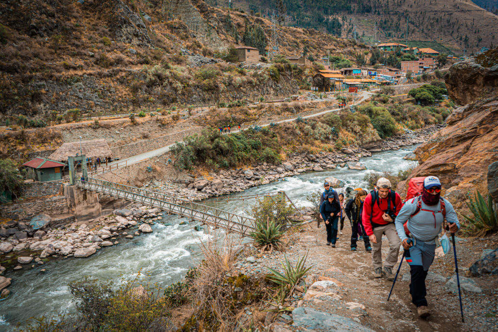
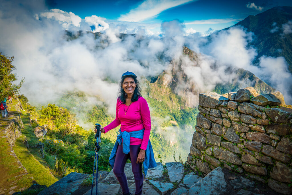
In the heights of the Peruvian Andes, where the air becomes thin and mountains touch the clouds, stretches a stone path that has defied time for more than five centuries. The Inca Trail is not simply a hiking route to Machu Picchu; it is a historical corridor connecting the present with the most powerful empire pre-Columbian America ever knew.
This 42-kilometer network forms part of the legendary Qhapac Ñan, the Inca road system that extended over 30,000 kilometers from Colombia to Argentina. For the Incas, these paths served not only as transport routes but also fulfilled crucial ceremonial, administrative, and military functions to keep united an empire that spanned territories equivalent to several modern European countries.
An Empire Built on Stone
The Incas developed their civilization between the 13th and 16th centuries in what we now know as Peru, Bolivia, Ecuador, and parts of Colombia, Chile, and Argentina. Their capital, Cusco, was located in the heart of the Peruvian Andes, from where they controlled a territory populated by more than 12 million people who spoke hundreds of different languages.
What distinguished the Incas from other pre-Columbian civilizations was their engineering capacity. Using techniques that baffle modern architects, they built roads, bridges, irrigation systems, and entire cities. Their constructions resisted devastating earthquakes that destroyed later buildings constructed by the Spanish.
The section of the Inca Trail that travelers walk today connected the Sacred Valley with Machu Picchu, following pilgrimage routes that Inca nobles used during religious ceremonies. Each stone of the path was strategically placed to create a road that would function for centuries without significant maintenance.
Extreme Geography: From Valleys to Glacial Peaks
The route crosses some of the most diverse and dramatic landscapes of the Andes. Participants experience altitude changes ranging from temperate valleys at 2,700 meters to mountain passes exceeding 4,200 meters, finally descending toward humid tropical forests where Machu Picchu is found.
Inca Trail Ecosystems:
- Inter-Andean Valley (2,700m) – Corn and quinoa agriculture
- High Andean Grasslands (3,500m) – Cold-resistant grasses
- Dry Puna (4,200m) – Minimal vegetation, extreme conditions
- Cloud Forest (2,400m) – Orchids, ferns, tropical biodiversity
This altitudinal variation creates what geographers call “Andean ecological verticality.” In a matter of hours, hikers pass from inter-Andean valley ecosystems with corn and quinoa agriculture, to high mountain grasslands where only grasses resistant to extreme cold grow, to cloud forests where orchids, giant ferns, and moss-covered trees prosper.
The most challenging point of the route is Warmiwañusca, known as “Dead Woman’s Pass,” at 4,215 meters above sea level. At this altitude, atmospheric pressure is 40% lower than at sea level, significantly reducing the amount of available oxygen. For many Europeans accustomed to maximum altitudes of just a few hundred meters, this experience represents a considerable physiological shock.
Architecture that Defies Gravity
The archaeological sites distributed along the Inca Trail demonstrate how the Incas integrated monumental architecture with extreme geography. Each complex reveals different aspects of its social organization, astronomical knowledge, and construction techniques.
Main Archaeological Sites:
- Patallacta: Agricultural terraces on vertical slopes
- Runkurakay: Circular control post with panoramic views
- Sayacmarca: Complex suspended on impossible hillside
- Phuyupatamarca: “Town above the clouds” with ceremonial baths
- Wiñay Wayna: The Temples integrated with jungle vegetation
Patallacta, the first major site of the route, exhibits the agricultural terrace system that allowed the Incas to cultivate on steep slopes. These terraces, known as andenes, included drainage systems, layers of different types of stone and earth, and specific orientations to maximize water and solar energy capture.
Sayacmarca presents one of the most impressive examples of Inca architecture adapted to impossible topography. The complex is literally suspended on a vertical slope, with retaining walls that have resisted five centuries of Andean earthquakes. Archaeologists estimate that its construction required transporting thousands of tons of stone along mountain trails using only human strength and llamas.
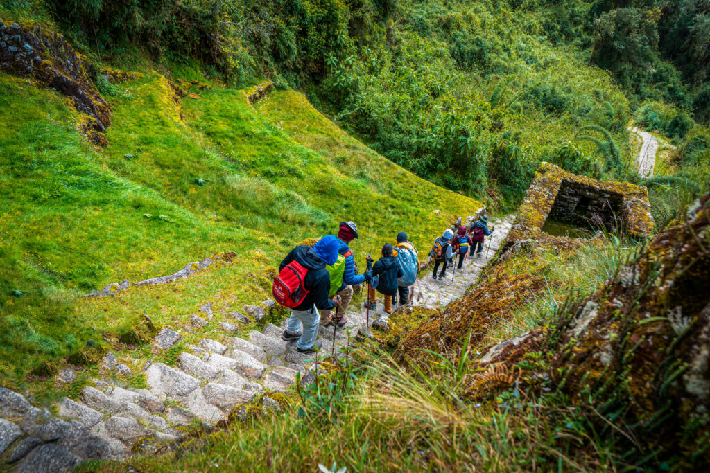
The Real Physical Challenge
The Inca Trail is officially classified as moderate to challenging, a categorization that reflects specific physical demands that participants must understand before the journey. Daily stages range between 6 and 8 hours of hiking over irregular terrain, with accumulated elevation changes exceeding 2,100 meters in four days.
Difficulty Factors:
- Variable altitude: 2,700m to 4,215m in one day
- Stone terrain: Irregular stones for hours
- Extreme climate: Intense sun by day, sub-zero cold at night
- Long days: 6-8 hours daily of intense hiking
Variable altitude constitutes the main difficulty factor. Physiological effects begin around 2,500 meters and include reduced lung capacity, accelerated heart rate, and in some cases, altitude sickness symptoms such as headaches, nausea, and extreme fatigue.
Mountain medicine specialists recommend a minimum acclimatization period of three days in Cusco (3,400 meters) before starting the trek. During this time, travelers can take day trips to different altitudes, allowing their bodies to gradually adapt to reduced oxygen levels.
Andean Seasonality: When and How to Go
The Andean climate presents two well-defined seasons that drastically influence the Inca Trail experience. The dry season (April-October) offers more stable conditions but also concentrates the highest tourist demand. During these months, precipitation is minimal, trails remain firm, and visibility is optimal for photography.
Inca Trail Seasons:
- Dry Season (April-October): Firm trails, clear skies, sub-zero nights
- Rainy Season (November-March): Green landscapes, fewer tourists, slippery trails
- Closure: Complete the February closure for mandatory maintenance
However, nighttime temperatures can drop below zero, especially between June and August. At Pacaymayo, the second day’s campsite is located at 3,580 meters, nighttime temperatures of -5°C are common during the austral winter.
The rainy season (November-March) presents a completely different character. Precipitation transforms arid landscapes into intense green meadows, temporary waterfalls appear at every descent, and constant fog generates atmospheres that few tourists experience.
Permit System: Controlled Tourism
Access to the Inca Trail is limited to 500 people daily, of which approximately 200 are tourists and 300 constitute support staff (guides, porters, cooks). This regulation, administered by the Peruvian government through SERNANP, represents one of the world’s strictest sustainable tourism systems.
Booking Data:
- Daily limit: 500 people total (200 tourists)
- Advance booking: 6-8 months for high season
- Group cost: $750-850 USD per person
- Private cost: $1,250-1,700 USD per person
Individual reservations are not permitted. Only tour operators with official licenses can sell permits, guaranteeing that all groups have certified guides, staff trained in first aid, and adequate equipment for altitude emergencies.
Permits for each year are released in October of the previous year, and the most demanded dates (May-September) usually sell out in the first weeks. Interested travelers must plan 6 to 8 months in advance, especially for the dry season.
Alternatives Without Restrictions
For travelers who cannot get Inca Trail permits, alternative routes exist that offer equally impressive experiences without access limitations.
Main Alternative Routes:
- Salkantay Trek: Glacial landscapes, no permits needed
- Lares Valley: Cultural immersion with living communities
- Choquequirao: Ruins more extensive than Machu Picchu
- Inca Jungle: Multi-adventure with cycling and zip lines
The Salkantay Trek presents possibly more dramatic landscapes than the classic Inca Trail. The route passes next to Salkantay peak (6,271 meters), considered one of the most sacred mountains for the Incas. The 4-5 day route requires no special permits and also culminates at Machu Picchu.
The Lares Valley offers authentic cultural immersion with communities that maintain ancestral textile traditions. Travelers can observe weaving techniques that remain essentially unchanged since Inca times and participate in genuine cultural exchanges with families who speak Quechua as their primary language.
Machu Picchu: The Final Destination
After four days of hiking, participants access Machu Picchu through Intipunku, the “Sun Gate.” This entrance exactly reproduces the experience that the Incas had during pilgrimage ceremonies from Cusco.
Machu Picchu, built in the 15th century and abandoned during the Spanish conquest, remained hidden until American explorer Hiram Bingham made it known to the world in 1911. The complex includes approximately 200 structures distributed on terraces that follow the natural contours of the mountain.
Machu Picchu Characteristics:
- Construction: 15th century, anti-seismic techniques
- Structures: 200 buildings on 32,500 hectares
- Functions: Urban, agricultural, and ceremonial sectors
- Recognition: UNESCO World Heritage Site since 1983
Archaeologists have identified urban, agricultural, and ceremonial sectors that demonstrate sophisticated urban planning. Hydraulic systems continue functioning after five centuries, astronomical orientations mark solstices and equinoxes with precision, and construction techniques have resisted earthquakes that destroyed later buildings in the region.
Following Ancient Footsteps: Your Journey Into Living History
The Inca Trail to Machu Picchu represents more than adventure tourism; it’s a transformative journey that connects modern travelers with one of the most sophisticated civilizations of pre-Columbian America. Every stone step echoes with centuries of history, every mountain pass reveals secrets of an empire that mastered the impossible.
For Europeans accustomed to different landscapes and altitudes, the Inca Trail offers a profound encounter with how an ancient civilization not only survived but thrived in one of Earth’s most extreme environments, creating architectural marvels that continue to defy explanation.
This is where Inkayni Peru Tours becomes your authorized gateway on the Inca Trail to Machu Picchu. We don’t just secure your permit, we craft an authentic, safe, and unforgettable expedition. Trust the specialists who have been guiding adventurers along this legendary route, ensuring every step of your journey honors both the ancient trail and your modern adventure spirit.