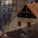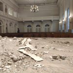
April 17, 2020 – What if there was a technology that allowed you to monitor movements on Earth to the nearest millimetre? Tech which could help assess the safety of buildings after the Zagreb earthquake, for example. There is. Meet Datel from Estonia.
The one country I am VERY keen to visit again after all this madness is over is Estonia.
My first visit was back in 1992 in the early days of the post-Soviet era, and my last a weekend break to Tallinn from the UK in 1996. And had it not been for an increasing interest in the digitalisation of Croatia and the VERY helpful lady representing Estonia in Zagreb during Croatia’s EU Presidency (remember that?), there my interest in Estonia might have ended.
But those Estonians are doing incredible things leading the digital revolution globally, and Zagreb representative Katre Sai has been incredibly helpful. Before all this madness, TCN was in the process of organising a trip to Tallinn with various forward-thinking mayors and other officials and representatives from the digital private sector, to visit Estonia and see what lessons could be learned and partnerships formed. That project is on hold for now for obvious reasons, but it will happen at a later day.
Apart from transparency, Estonia also has some fantastic tech startups – indeed the four Estonian startup unicorns of Taxify, Skype, Transferwise, and Playtech mean that Estonia has the highest number of unicorns per capita in the world.
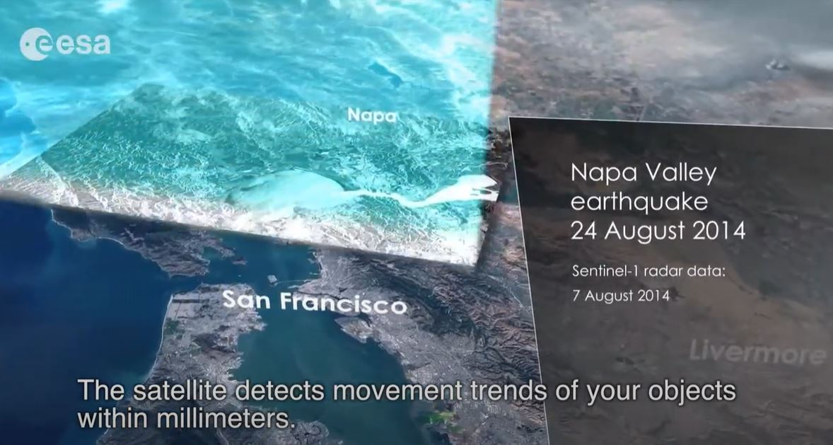
And now, something rather incredible to add to that list, which was sent to me by Katre and could be a great help in helping assess the danger of the many damaged buildings from the Zagreb earthquake – Estonian technology from Space which tracks the tiniest movements on Earth, which can enable damage assessment:
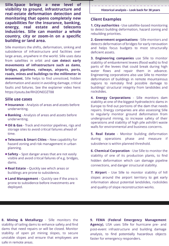
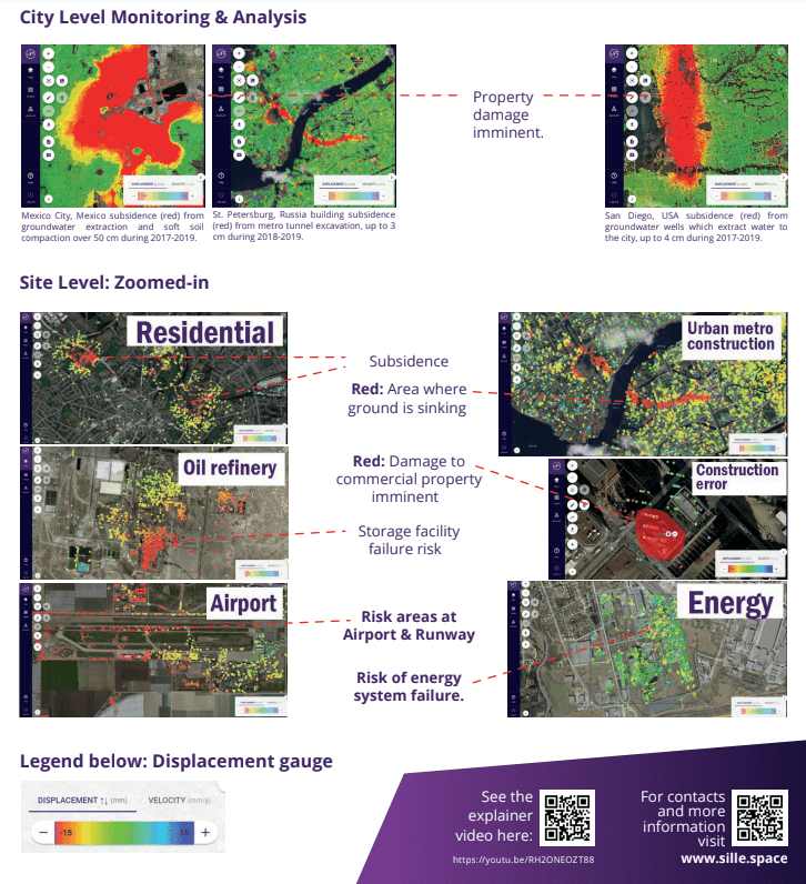
An Estonian company has reached out to us after the earthquake to introduce their solution for situations similar to this. The name of the company is Datel and they have created a product which enables to detect building and infrastructure deformation using remote sensing satellites to find damaged and hazardous objects, that could be dangerous. Before the earthquake the system can detect building and infrastructures that are structurally deficient (they have 5 years history), thus have a great probability to collapse or fracture. After the earthquake, the system can detect buildings and infrastructure that was damaged (deformed) the most, and the rescue crew can focus their attention (and operations) first to the most damaged objects, saving time and money. Also, the state engineers can use this data to inspect the damaged buildings, which could be unnoticed otherwise. The results are by default delivered in an online map application and ready to use at once.
Rather than me comment as this is not my field of expertise, check out the info below and the VERY informative video. I hope this is useful for some in authority – please feel free to share the service. It has applications far beyond Croatia’s borders obviously. You can learn more about Datel and the Sille Space technology on the official website.