YouTube channel EdoStuff published a video on their YouTube channel on October 2, 2016 showing drone footage of the Cetina river spring Glavaš lake, the largest source of the Cetina river.
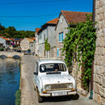
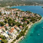
Cetina has a length of 101 kilometers and its basin covers an area of 1,463 kilometers2. From its source, Cetina descends from an elevation of 385 metres above sea level to the Adriatic Sea. It is the most water-rich river in Dalmatia and is the longest Dalmatian river. It rises at the foot of Dinara, near the eponymous village of Cetina, which is 7 kilometers north of Vrlika. The sea flows all the way into Omiš.
The Cetina river has its source from eleven karstic “vrila“ (springs), with the principal spring being Glavaš – its “lake-like” form situated near the small village of Cetina. This spring is of a turquoise blue color, and runs 130 meters deep.
YouTube channel EdoStuff, made up of 95% aviation related videos with the other 5% being nature videos or events from their hometown of Split, posted a video just two days ago with drone footage circling the stunning Cetina, and specifically Glavaš lake. “Go-Pro” footage was even captured covering the depths of the river underwater. The video thus far has nearly 4,000 views, and we can see why.
https://www.youtube.com/watch?v=v=Gh7CLMpmBn8