October 18, 2020 – The first children’s map of Split, Solin, Kaštela, and Trogir has been launched by the Split Scout Association.
Slobodna Dalmacija reports that Split and the surrounding cities of Solin, Kaštela, and Trogir received the first children’s map of their areas, realized through the project “SCOUTCITY – a city tailored to children” led by Ivan Jarebic, head of the Split Scout Association.
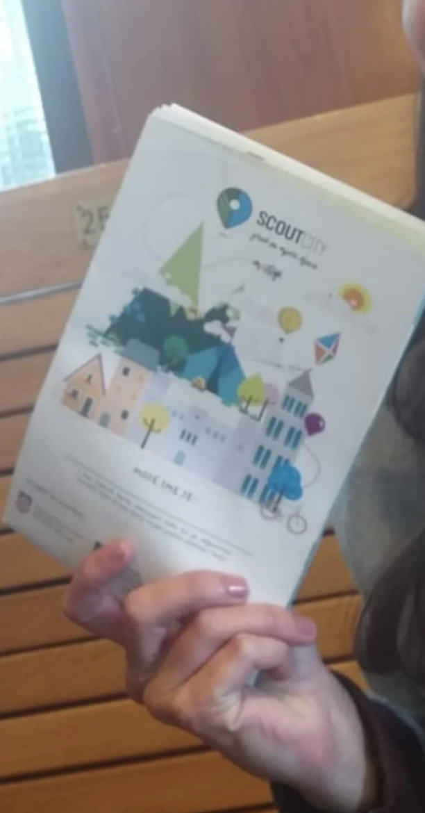
According to Edi Perić, president of the Split Scout Association and the creator of this map, it was originally conceived as a summary of information for children and parents about facilities (sports clubs and civil society organizations) that offer extracurricular activities, which is its content.
Private Album
All primary schools, city museums, and striking historical and cultural monuments are inscribed in it. The map designer is fellow citizen Vana Bašić, a visual design student in Split who is in her final year.
However, thanks to the cooperation with “Parks and Plantations,” more precisely with their landscape architect Igor Belamarić, this document has turned into an excellent teaching aid in biology, especially regarding the biological heritage of Split and the surrounding areas.
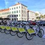
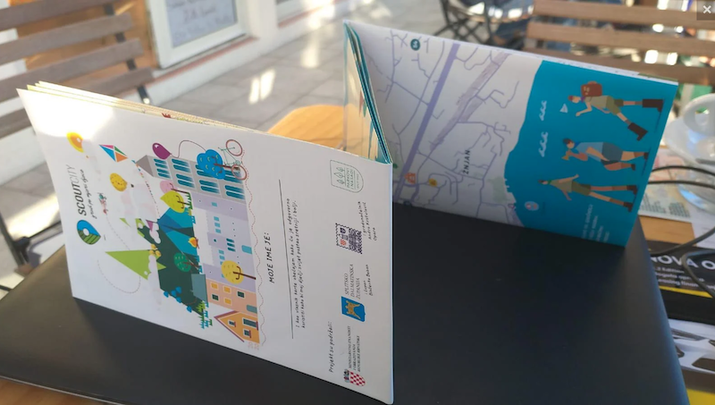
Thus, the map contains a list of typical Split trees, a simple vegetation map of Marjan, listed Mediterranean plants in the park, areas protected by Natura 2000, as well as places in Split with publicly available drinking water (without water on the beaches), stations for electric bicycles, bike paths, places available for children with pets, and all children’s playgrounds under the jurisdiction of “Parks and Plantations.”
It is interesting to note that Edi Perić and Igor Belamarić met during a joint visit to Tirana a year ago, organized by the City of Split, led by Mayor Andro Krstulović Opar, who was personally in the delegation.
Private Album
“Igor joined us with full strength as a volunteer, so that our meeting in Tirana led to exceptional cooperation that, we both believe, continues. Our next content for the children of our city will be in the same co-production and will be even more attractive,” announces Perić.
According to Perić, Split-Dalmatia County prefect Blaženko Boban also stood behind the project, so the digital form of this map has just started to be made in the county IT sector.
“Many have contributed to this achievement, and the cooperation with Igor, a lover of his profession and a dedicated volunteer contribution, is an example to all others. Thanks to the City of Split and the Mayor for the partnership on this project, which was funded through a tender of the Ministry of Science and Education and to a lesser extent by the County,” he states and adds that every child in all Split primary schools visible on the map, including Žrnovnica, will receive a free copy.
To read more about lifestyle in Croatia, follow TCN’s dedicated page.