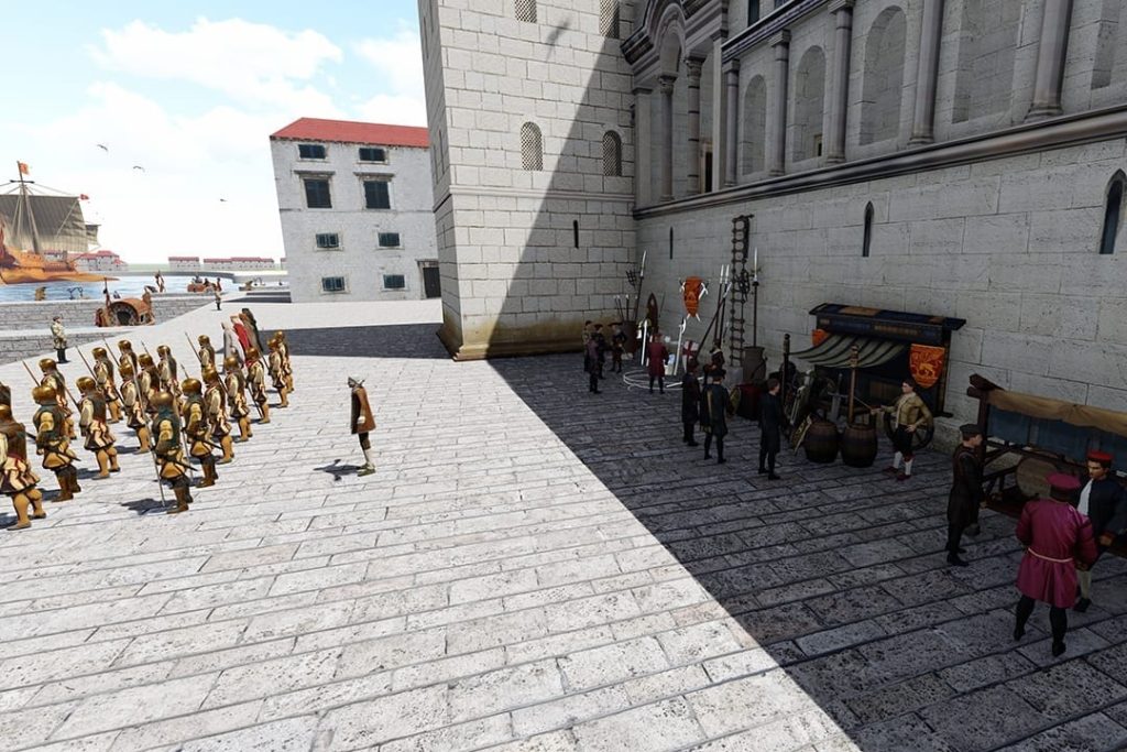
November the 22nd, 2024 – Most people who have been to Croatia have visited its second largest city, but have you ever wondered how it looked in ancient times? Let’s embark on a trip to Split in 1666.
The Venetian Empire ruled over vast swathes of the Croatian coastline in times long gone by. It looked upon the then autonomous Dubrovnik Republic (Ragusa) with eyes full of envy, and merchant ships belonging to both Venice and Ragusa sailed the Adriatic Sea, sometimes being plundered by the pirates of Omis.
It’s difficult to imagine the Croatia as we know it today as it was all those centuries ago. In 1666, Split was under the rule of the mighty Venetians from across the Adriatic, and it remained so for 377 years.
As Morski/Stjepan Udjur writes, if we turn the clock all the way back to the year 1420, we’ll be witnesses to Venice taking over Split, which it ruled until 1797, a total of 377 years. At first, when the Venetians came to inspect the quality of Split’s defences, they were surprised by its exceptionally poor defensive fortifications.
Split was poorly guarded, with fortifications that could only have been useful for hand-to-hand combat and were not suitable for firearms or cannon fire, which the Ottomans used. The Senate sent various experts to build defensive fortifications in Split, to carry out inspections and make proposals for defensive bastions.
As such, the description of two syndics in Dalmatia in 1525, Leonardo Venier and Girolamo Contarini, highlights the weakness of Split due to the very old, crumbling walls around which there were no moats.
The description belongs to a very systematic, detailed and clear report on Split compiled by the providor Antonio Pisani, presenting in it the assessments of Antoine de Ville. This proclaimed French engineer had arrived in Split from Pula up in Istria, where he was constructing a quadrangular fortress. As a respected expert, he was supposed to give recommendations for interventions needed down in Split. Onofrio del Campo stated that Split was almost helpless, and according to him, the Senate had ordered that it simply be blown up in the event of an attack.
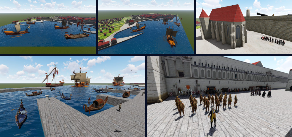
Split remained insufficiently fortified, which was agreed upon by all reporters and engineers. Thus, in 1654, at the initiative of Baron Herberstein, several military commanders and engineers (signori Capi, et officiali da guerra) were invited to assess the state of the city and to offer their advice on ensuring it becomes better protected in future.
Among the various assessments, the analysis signed by Magli and Benaglio should be mentioned. The pair confirmed that Split was inconveniently located and that its fortifications were very weak, but that nothing more could be done without considerable expense. This was followed by interventions instigated by Camillo Gonzaga, commander of the infantry in Dalmatia, who was also a designer of fortifications. His short-lived activities in Split took place under the rule of the general providur Bernardo (1656-1660), who was particularly committed to the construction of Dalmatian fortifications.
In this context, he made a provocative and undoubtedly accurate assessment that the Split construction project would be the largest the Republic had undertaken since the time of Palmanova. Del Campo claimed that his proposal for the optimal fortification of Split was essentially identical to the draft signed by Conti and accepted for implementation.
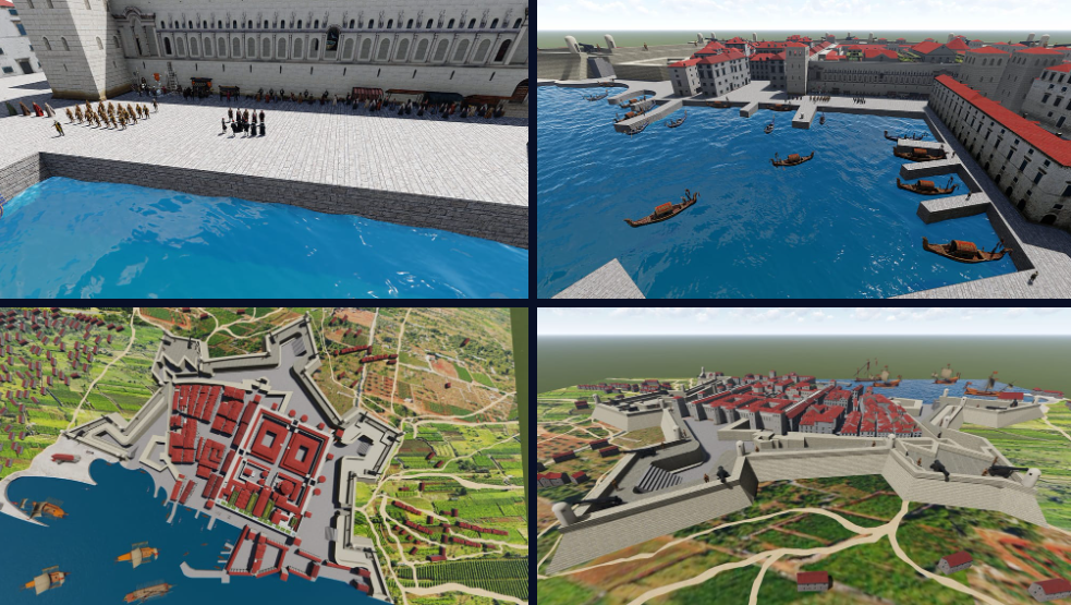
That’s when we arrive in Split in 1660, when I. Conti arrived. His project for a new defensive belt was readily accepted. Construction began with the central northern bastion, called Corner, before continuing with the eastern bastion (Contarini), then the western half-bastion near St. Francis and the south-eastern half-bastion near the lazaretto was built. The state of construction of the fortifications of Split back in 1666 is shown by Santini’s precise floor plan, which was used to create the above 3D model.

