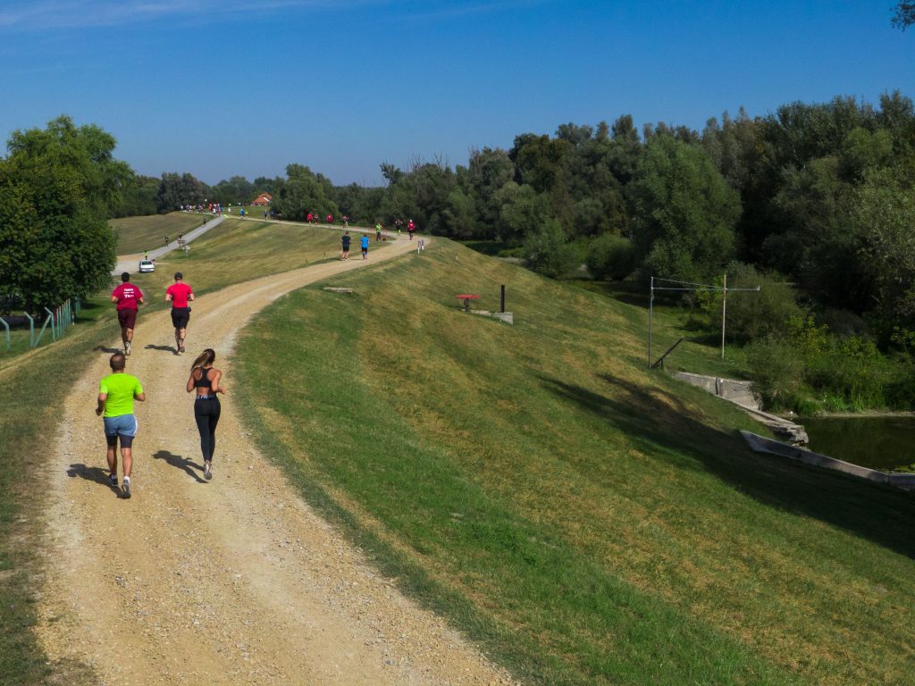
November 6, 2020 – Is there a better way to get to know the beauty of Croatia than with physical recreation? To help you successfully combine pleasure and exercise, we present a list of the top 10 best running routes in Croatia.
Whether you are a lover of tranquility, nature, and fresh air, or are amazed by the winding roads along the rivers or the beautiful views from the mountain tops, in these top 10 best running routes, everyone will find something for themselves. From Slavonia and Zagorje, through Istria, Kvarner, and Lika, all the way to Dalmatia, RunCroatia collected the top 10 running routes in Croatia, described and photographed by the running enthusiasts themselves.
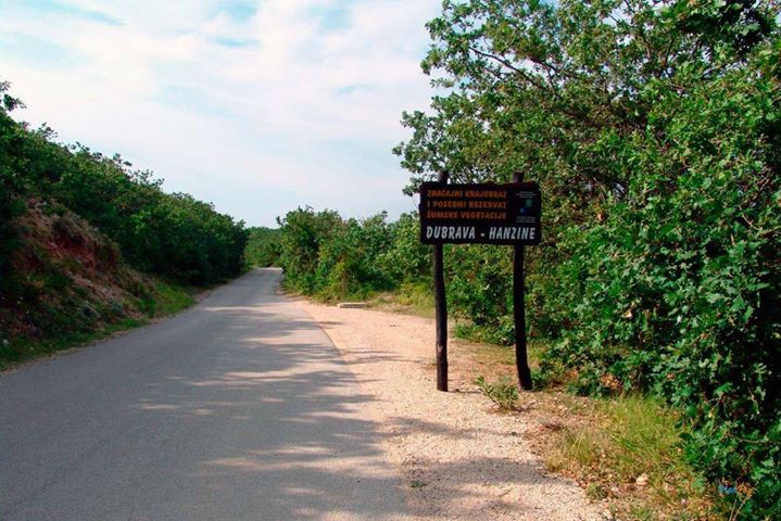
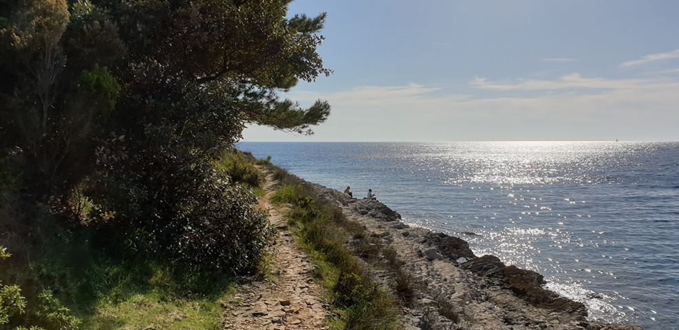
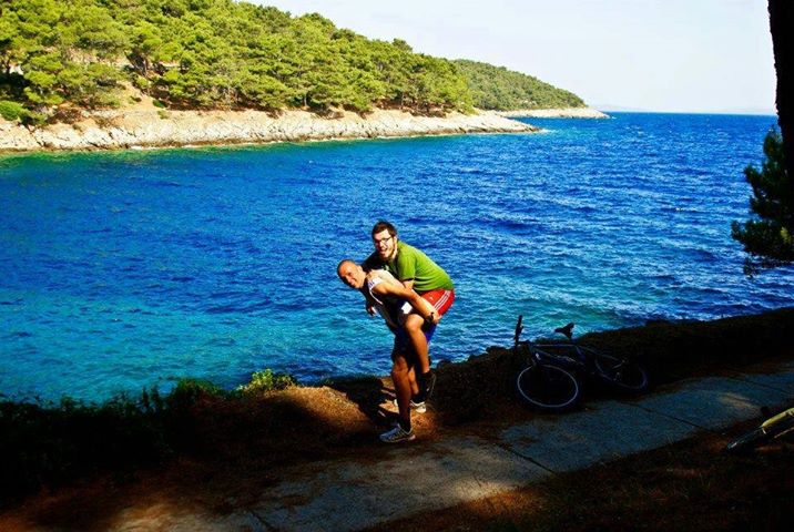
1. Bošana, Pag
Running in the company of a flock of sheep
Text and photos: Alan Sinovčić
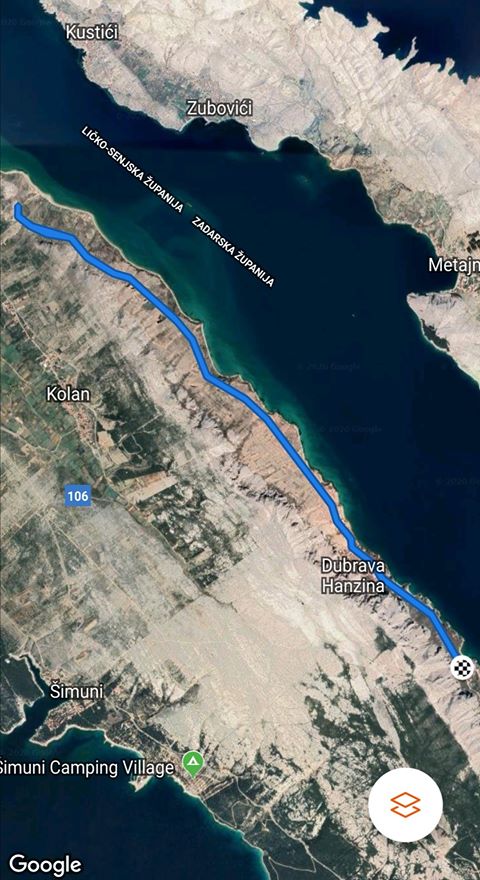
My favorite running track is on the island of Pag, on the old (mostly macadam) road from Pag to Novalja. The trail starts in Bošana, a part of the Pag town that is very easy to reach – you go north from the city and then take the road by the sea.
About a kilometer after the last houses in Pag begins Bošana, a small secluded place, special for the forest with which it is covered. After about another kilometer and a half, you will reach the end of Bošana where you will notice a sign indicating a special reserve of forest vegetation. There is a small parking lot where you can leave your car and go down a little lower along the way to see the beautiful beach Rozin bok.
The first kilometer and a half runs through the woods along the paved road to Sveta Marija, a place with several houses. After Sveta Marija, the path continues on the macadam. On the left side, there is a very steep path to the highest peak in Pag, Sveti Vid (351 m), and on the right side, there is a view of some wonderful beaches, among which is the beach Paška vrata, and Velebit mountain. After a little over two kilometers, on the right, there is a standard spot for photography and a sign for the 15th meridian that passes there.
Another place with just a few houses follows – Sveti Marko. The trail continues along with many coves and beaches, out of which the 750-meter-long Filino beach should be specially noted. Part of the road to Filino beach is the “hardest” – it is about 500 meters of an easy ascent. This is followed by a slight descent towards the Camp Sveti Duh.
On the left, you will pass an old pit for digging sand, and in that part, you can even expect frequent encounters with flocks of sheep. The end of this part of the trail is windy. First, there is an ascent (arrival at the paved part), and then a descent to the entrance to the camp.
The one-way trail is 7 km long. For those who want more length, I suggest that they run the road Pag – Novalja above the camp and continue on macadam roads to Gajec, an apartment complex near Novalja, which will add another 5 kilometers in one direction.

2. Dramalj, Crikvenica
For early morning lovers
Text and photo: Pero Petra
This trail goes by the sea without big ascents. The best time to go is in the morning because it’s in the shade. After one kilometer, you come to Kačjak, a small peninsula that has a trim track and is designed as a sports complex. The view overlooks Krk, Klimno Bay, and the gently sunny completely calm sea in the early morning called „bonaca“. The circle along the peninsula can be extended. You can go back towards the beginning, towards Jadranovo along the new road or towards the beginning and along the coast to Selce.
This trail offers something for everyone. Whoever finds themselves in the Crikvenica town, this route is great. It’s best when you meet a team coming back from a night out!

3. Kamenjak Cape, Premantura, Istria
Where the dinosaurs walked
Text and photos: Domagoj Kranjčec
The Kamenjak peninsula is located in the southernmost part of Istria. The smell of medicinal herbs and salt, the buzzing of bees, and the murmur of the sea on Kamenjak can best be experienced in early spring and late summer. Almost 100 million years ago, dinosaurs walked through Kamenjak, and today in the summer months, it is full of walkers, runners, cyclists, and cars. Cape Kamenjak is full of macadam roads, narrow roads, and bike paths.
A circle of 15-20 kilometers from about 150 meters above sea level can be achieved by connecting Gornji and Donji Kamenjak. If your start is in the center of Premantura (near the church and the tower), head north in the direction of Pula. One hundred meters from the sign to leave Premantura, turn slightly to the left and continue along the macadam road, slowly ascending to the top of Gornji Kamenjak, where there is a large cross.
From this place, there is a beautiful view of Pula and Volme to the north, Pomer, and Medulin to the east and Cape Kamenjak to the south. Head back downhill 100 meters and turn right first to run with a view of the open sea on the west side, and again emerge on the famous path that takes you back to the very entrance to Premantura.
After the sports field, turn right onto the paved road that leads to the official entrance to Kamenjak (house with a ramp). Next, you have several trails to the cape, and my recommendation is to head towards the bay Polje and then along the narrow roads all the time running along the sea to visit the remaining bays to the Safari bar. Here you can share a gravel road with cars or cross the east side of Kamenjak to get back to the center of Premantura and your starting point.

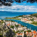
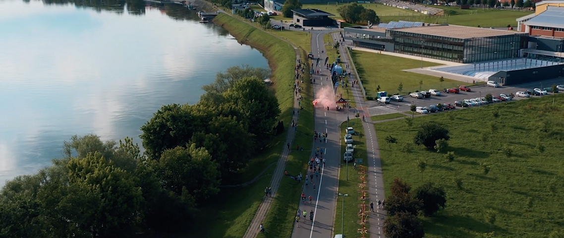
4. Slavonski Brod, along the Sava River
Along the most beautiful Croatian river beach and square
Text and photos: Boris Predmerski
Polojska cesta (Poloj road) in Slavonski Brod, named after one of the most beautiful river beaches in Croatia – Poloj (eng. field), is an unavoidable route for all recreationists and runners. The informal start of the running route is at the Vijuš sports hall complex and the city swimming pools located right next to the Sava River. It has a large parking lot, as well as an excellent plateau for warming up.
The route starts from the pool and goes through the Polojska cesta. The entire length is paved (but you can also run on grassy terrain along the trail), runs along the entire length of the Sava River, more specifically along the beautiful rafting street. Along the route, there is exercise equipment and a skate park.
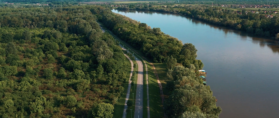
From the pool to Poloj, the length is 2.5 km. There is a turn on Poloj, with the remark that you can also extend the route (we call it pockets) by circling around the cottages right next to a large sandy river beach. For those who want to spend more time in nature, they can run part of the way through the forest and feel a little trail atmosphere.
On the trail, there are three replicas of old Slavonian backyard water pumps and you do not need to carry refreshments with you.
You return on the same route to the pools where you end up running 5 km. But that’s not the end. If you want a longer length, continue along the Sava towards the bridge. Run along the beautiful Sava promenade (quay) to the bridge with a slightly shorter length of 2 km where you make a turn.
Along this part of the road, you will inevitably be accompanied by kayakers and walkers. You will run next to the baroque Franciscan monastery, next to Ivana Brlić Mažuranić Square, the main town square, which in 2006 received the Croatian National Tourist Board award for the most beautiful square in Croatia.
Under the bridge, you can turn back. You will be greeted by anchored riverboats and fishermen on one side, and on the other side by the baroque and magnificent Fortress ship. Going back, you will run less than 10km, but with the aforementioned pockets on the Poloj, you will have a dozen kilometers under your feet.
I mentioned the Fortress ship above – it is a racing story in itself. In the very center of the city, kilometers circle through the paths of the largest fortified baroque buildings in Croatia and one of the largest in Europe. Running through baroque casemates and fortress tunnels take you back to the 18th century when it was built. A unique “Cross in the Fortress”, as well as the “Slavonian Race” which starts and ends in the Fortress, are organized here.

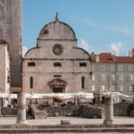
5. Šibenik, promenade Sveti Ante
Perfect surface
Text and photos. Ljiljana Šarić
The route is 5.6 km away from Šibenik and stretches along the seaside, where is the Channel of St. Anthony near the Fortress of St. Nicholas. The path or promenade is used by many, not only because of the beautiful view, but the surface is perfect for running or walking. The Šibenik Triathlon has been held on this track for two years and all participants are delighted.

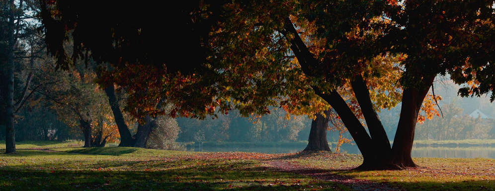
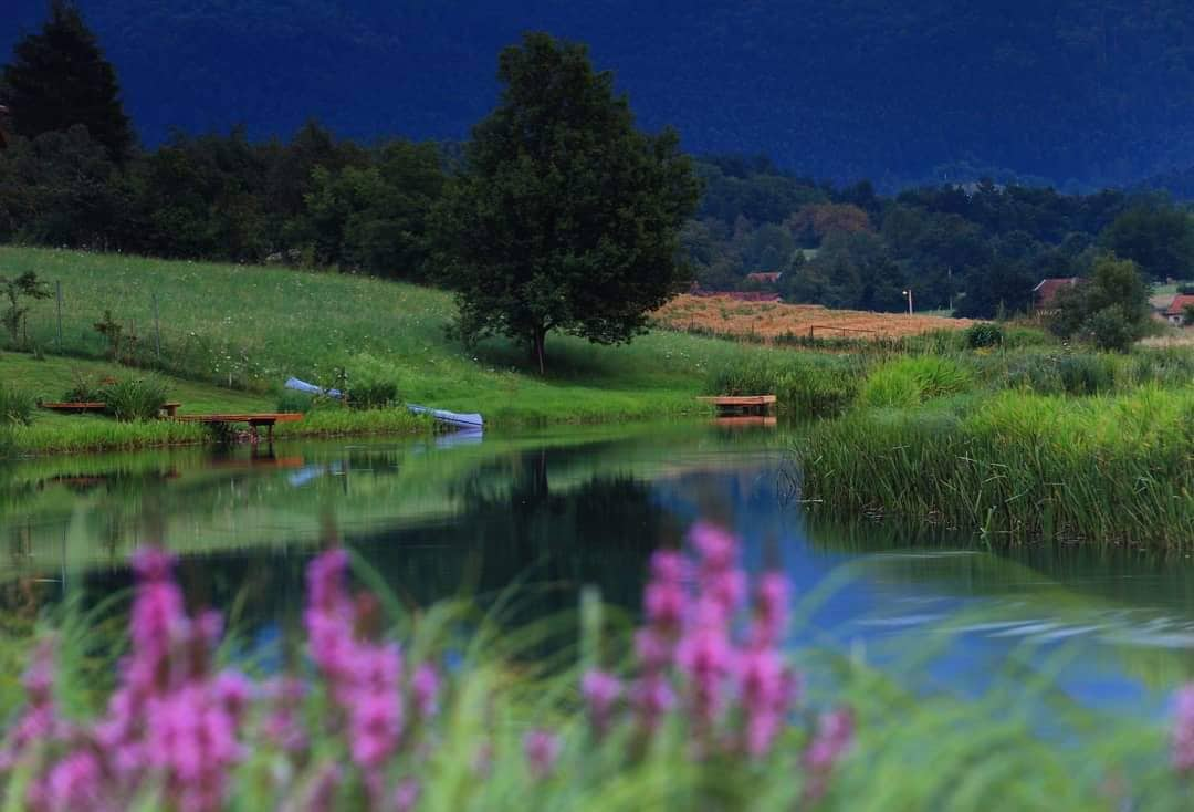
6. Ludbreg, Crazy Hill Trail route
All the beauties of Ludbreg
Text and photo: Drazen Komes
One of the starting points is the Island of Youth – a small green oasis in the center of Ludbreg bordered by the Bednja River with many lakes, a paradise for animals and fishermen. After running around the Island, you pass by apple orchards, cornfields, and steep vineyards to the forest that abounds in many hidden ravines and streams, and at the last ascent and just before the last descent a view of the whole Ludbreg. The trail is an ideal opportunity to present widely all the beauties of our region, our people, and customs.
7. Mali Lošinj
Outdoor spa on the Island of Vitality
Text and photo: Goran Todorov
Some of the shots are from the trail where a large number of tourists run. In my opinion, that 10-13 km is certainly the most beautiful trail I have ever run, if not the most beautiful, and I have run a lot of them. The sound of the waves, the special scent of the forest, hidden coves, and the song of seagulls. Paradise!
Perhaps one of the most beautiful promenades in the world leads you about 3 km from the direction of Hotel Vespera, through the Camp Čikat, to the old resort of Petrokemija.
Lošinj is also known for its outdoor spa. When you are there and inhale that air, the smells are more special than ever, and the views that reopen after each new bend simply take your breath away.
The trail is arranged and relatively flat and leads you along the sea, next to camps and hotels. There’s a special view all the way and a special atmosphere in the race. After the old resort of Petrokemija, about 3 km away, the paved path ends, but it is possible to run below, but the path is of the lighter trail profile and goes about 2 km in the direction of the city.
8. Otočac
A circle along the Gacka River
Text and photo: Josip Loškarin
Gacka Valley, an hour and a half drive from Zagreb, Rijeka, or Zadar, known for its beautiful river and natural beauty, is an ideal place for walking, running, hiking, or cycling. Members of the racing section of the Otočac Sports Club have singled out an interesting 10 km long road track.
The trail is circular, starting and ending in the City Park in Otočac. It largely follows the river Gacka on both sides of the coast, passing through the mountainous but gentle landscapes of the Gacka Valley. The trail has a total elevation of 74 meters.
Detailed description:
The trail starts in the Otočac City Park (A) in a westerly direction and turns left towards Ban Josip Jelačić Street (B). Then continue straight through Luka Street (C) and further towards the village of Prozor (D) to Prozorski dom (E) where you turn first right and then at the next crossroads before the bridge turn left. You continue straight up a slight hill to Orešković bridge (F), after which you turn right towards Šatrići (G). At the next intersection, turn right up a slight hill to Obilje (H) and continue without turning to the Port Bridge (I). After the bridge, turn left and return through Luka (J) and Ban Josip Jelačić Street (K) to the Otočac City Park (L).
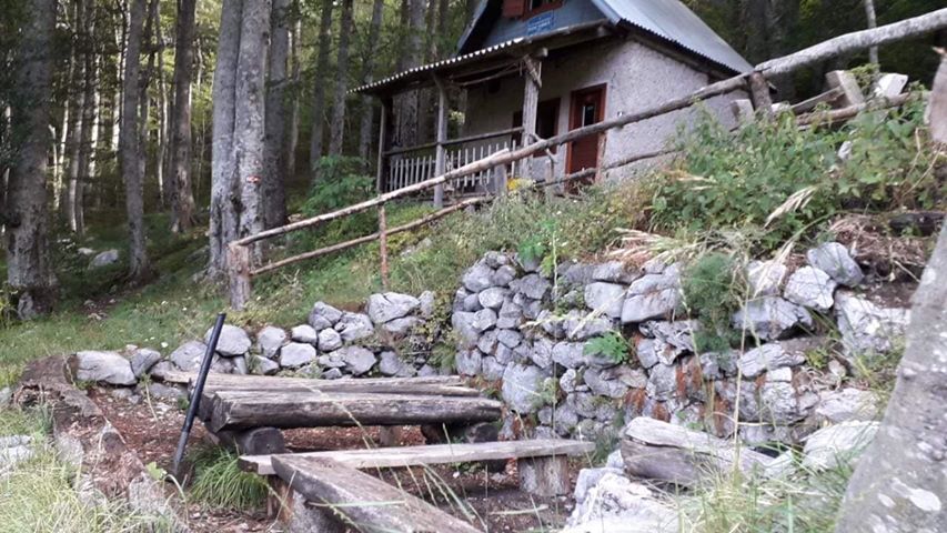
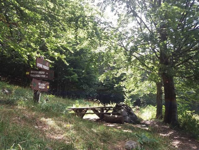
9. National Park Paklenica, Ivine vodice
Refreshment in the hot months
Text and photos: Andrija Savić
Among all the tracks of National Park Paklenica, this track stands out with its aesthetics and simplicity. The trail starts from the mountain lodge Paklenica and goes to the mountain shelter Ivine vodice. In one direction it is 5.5 km, and the slope is 12.2 percent. It is also one of the easiest trails since it has a slight slope (the last third is the steepest) and it is a trampled single-track.
At the mountain lodge, there is a pool where you can bathe and recover in the summer months, given that the water temperature is around 15 degrees. You can always catch axes and chop some wood on Ivine vodice and thus spice up your training. The trail runs through the forest all the time which is ideal for the hot months. All in all, a real treat for trail racers looking for clean air.

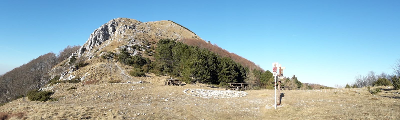
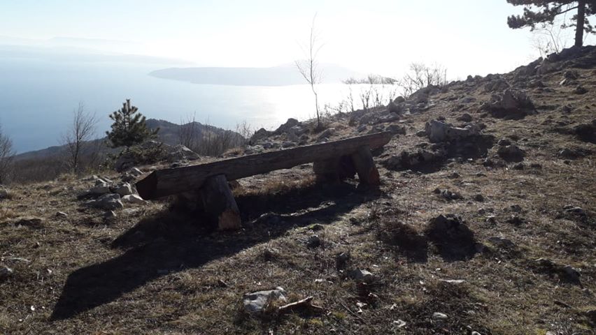
10. Učka
A view from the top of Istria
Text and photos: Marko Jelić
The route I usually take starts from Moščenička Draga. Along the coast, take the 750 steps to Moščenica, which overlooks Rijeka and Kvarner. From Moščenica, the road continues to Mala Učka. From Mala Učka, I head towards the beautiful Babin Grob lookout point, which houses a shelter and a lodge. Back from Mala Učka, sometimes I turn to Suhi Vrh.
I continue my journey to Vojak, the highest peak of Učka mountain, and therefore the whole Istrian peninsula. From there, there’s a view of the whole of Istria, the islands, Risnjak, and Slovenian mountain peaks. The options are many but for me, this route is favorite!
For the latest travel info, bookmark our main travel info article, which is updated daily.
Read the Croatian Travel Update in your language – now available in 24 languages
Join the Total Croatia Travel INFO Viber community.