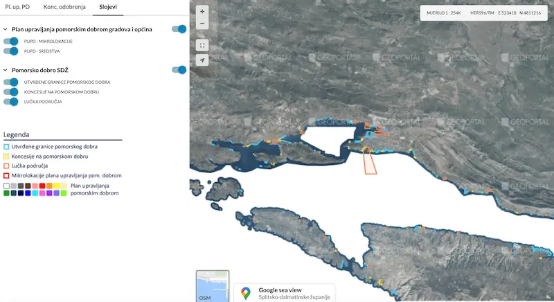
HRTurizam reports that Split-Dalmatia County is the first in Croatia to implement a unified Information System for Split-Dalmatia County Maritime Property Records, ensuring the legality and transparency of operations and the availability and accuracy of all information regarding maritime property management as a precious natural resource.
It is a tool that combines the registers of established maritime domain boundaries, concessions on the maritime domain under the jurisdiction of Split-Dalmatia County, port areas, maritime domain management plans of cities and municipalities, and concession approvals on the maritime domain under the jurisdiction of local governments. Each of these registers consists of a database of spatial and attribute data and the associated documentation.
Split-Dalmatia County Prefect Blaženko Boban welcomed the Information System, which with the click of a mouse allows citizens to get all documents, contracts, decisions, the number of deckchairs, and the quantity of what the individual entity has received a concession for, and on that basis can immediately react to the inspection services via mobile phone.
After the training organized by the Board for Tourism and Maritime Affairs of Split-Dalmatia County in 2020, the number of cities and municipalities that developed the Plan through the application has grown, and today, you can look into 297 micro-locations, almost 2,500 funds on them, and over 1,000 entered items issued concession approvals. To date, 27 Maritime Property Management Plans have been developed, and a total of 400 cases from the area of maritime domain boundaries and concessions and 52 port areas have been digitized.
The system was developed as a publicly available web gis application based on open source technologies, emphasizing functionality and simplicity, and optimized and adapted to users, their tasks, and expertise.
Almost one click shows all the decisions and changes to the decision on concessions, and you can see exactly the type of concession. This application will be useful for the citizens and for the inspections to determine the factual situation. Everyone can report the devastation of the maritime domain through the application.
The system is publicly available to all citizens at: https://www.pomorskodobro.dalmacija.hr/
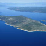
Split-Dalmatia County was also the first in Europe to introduce Google sea view. This is a novelty on a European scale, in which the famous Google system ‘Street View’ received a sea route for the first time. And with it a depiction of the entire coastal belt of a region.
For more, follow our lifestyle section.
Subscribe to our newsletter
the fields marked with * are requiredRelated posts:
 Funding Approved for New Split-Dalmatia County Waste Management Center
Split-Dalmatia County Secures Four Million Kuna for 300 Families in Rural Areas
Split-Dalmatia County Signs Large Infrastructure Projects, Including Water Purification for Jadro
Split-Dalmatia County Joins Movement to Keep Coastline Free of Cigarette Butts
Funding Approved for New Split-Dalmatia County Waste Management Center
Split-Dalmatia County Secures Four Million Kuna for 300 Families in Rural Areas
Split-Dalmatia County Signs Large Infrastructure Projects, Including Water Purification for Jadro
Split-Dalmatia County Joins Movement to Keep Coastline Free of Cigarette Butts